Figure 1
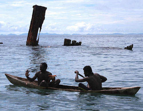
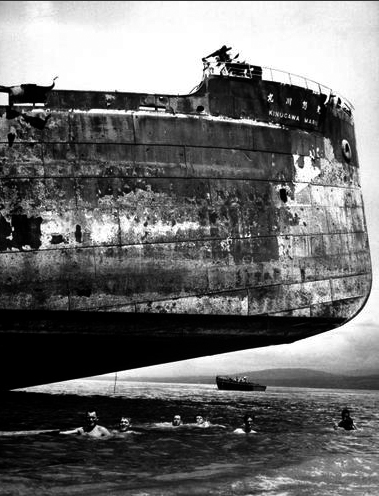
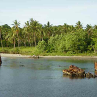
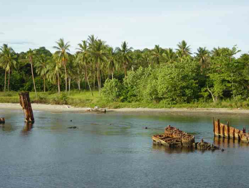
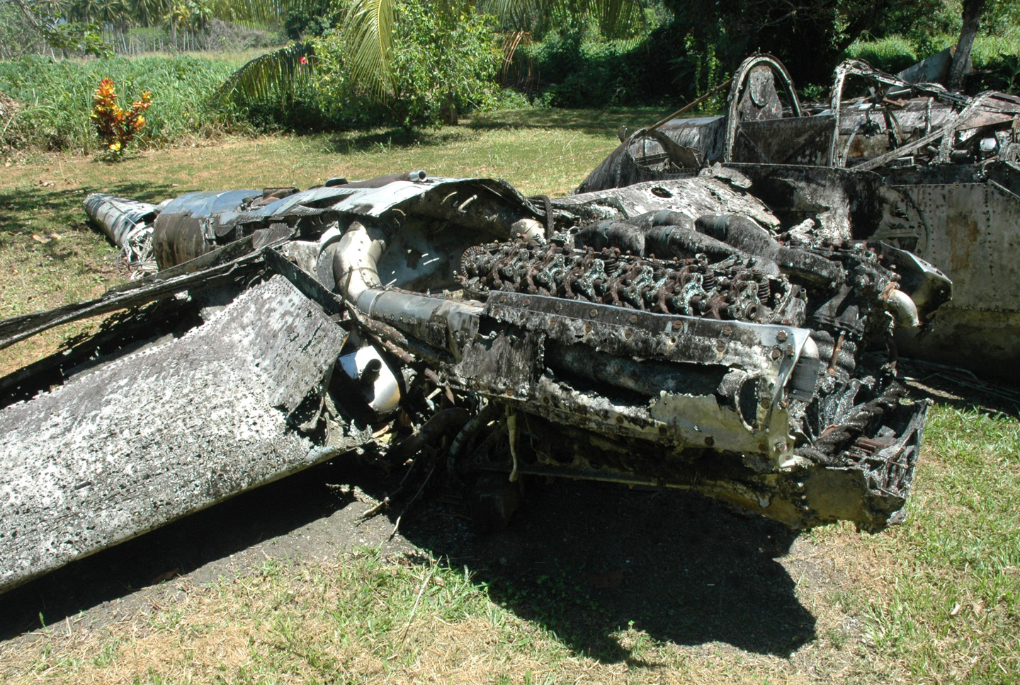
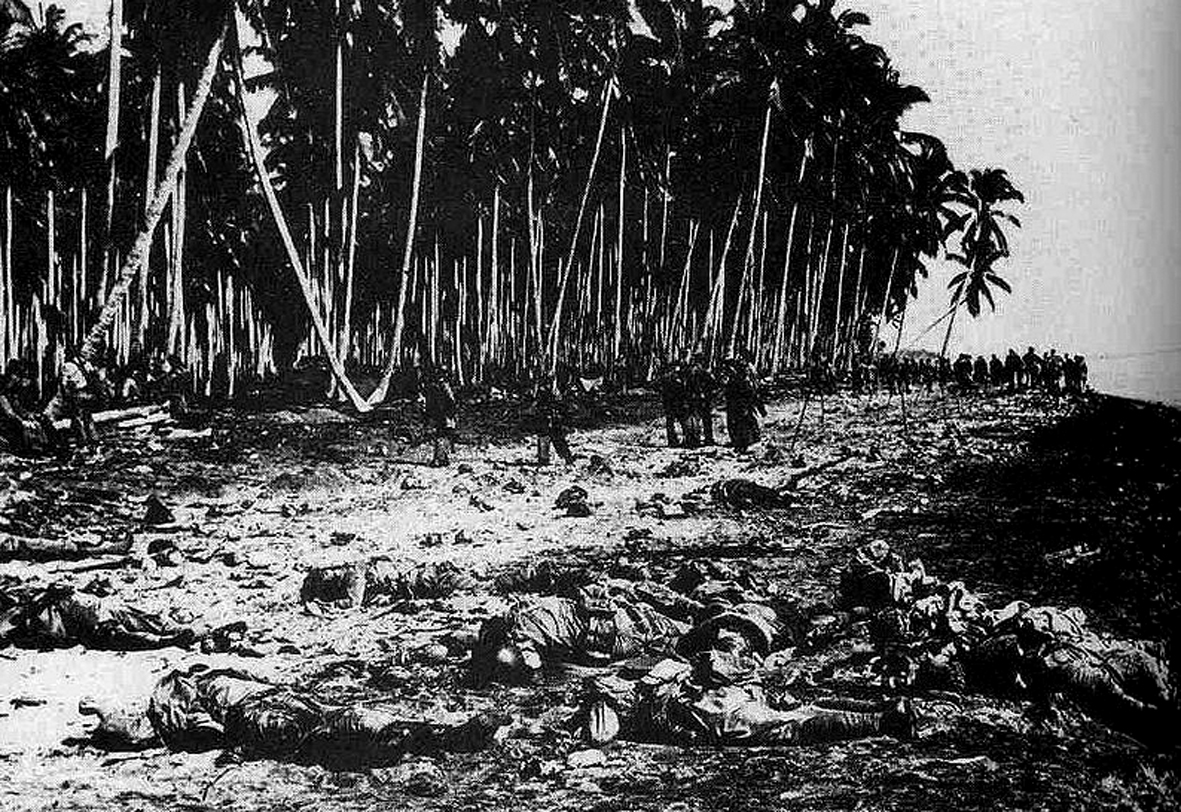
First on of my list of places to visit was the site of the wreck of the Japanese transport ship, the Kinugawa Maru (Figure 1). Half an hour’s drive up the coast, the ship, along with three others, had been attacked by American naval artillery and aircraft as it attempted to land reinforcements and supplies to recapture the island 15 November 1942. My father had visited the wreck, swam out to it and climbed over it. Little is left of it now, but the experience of standing on the beach where my father had nearly seventy years ago was very moving. I imagined him as a 23 year-old soldier wading into the water with his mates to swim out to the ship. The wreck was a favourite subject for official and amateur war artists among the New Zealand servicemen and although there is little left of it above the water surface, it is a popular diving spot today. Figure 1 photograph records the ship under attack by American artillery fire based at Lunga Point (19,500 meters away to the east) and B17 bombers. Figure 3 shoes the bow section of the beached transport. The Kinugawa Maru’s sister ships slipped into deeper water and sank, while the Kinugawa Maru herself remained firmly stuck with her bow on the beach and her stern under water. Figure 4 shows the remains of the ship’s engines protruding from the water.
-
- Figure 2
-
- Figure 3
-
- Figure 4
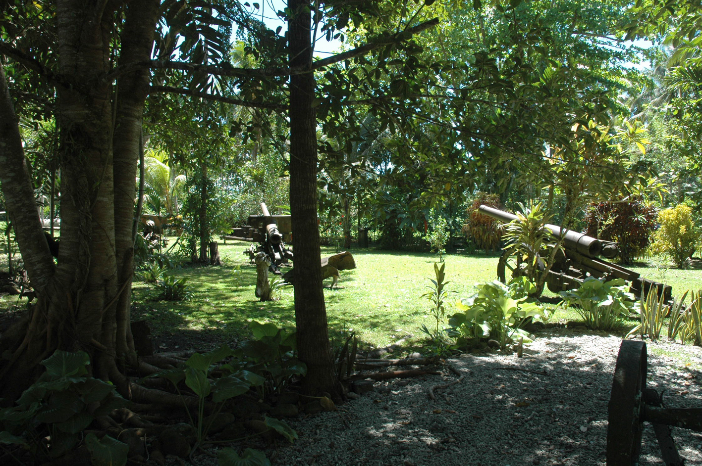
Further up the coast Stanley took me to the open-air museum at Vilu, where a local man has collected wrecks of American and Japanese aircraft, artillery pieces and other rusting and deteriorating aircraft and military equipment in a beautiful garden setting (Figures 5 – 8).

Figure 5
Mosquitoes buzzed around me constantly. I slapped them from the back of my neck. I was glad I had taken my anti-malaria tablet and smothered myself with repellant before we left the hotel.
-
- Figure 6
-
- Figure 7
-
- Figure 8
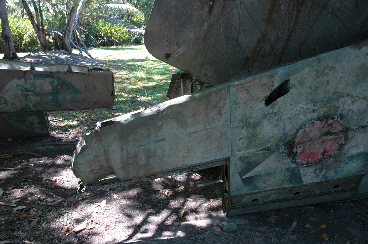
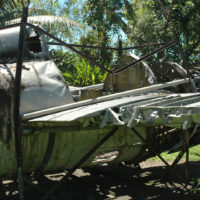
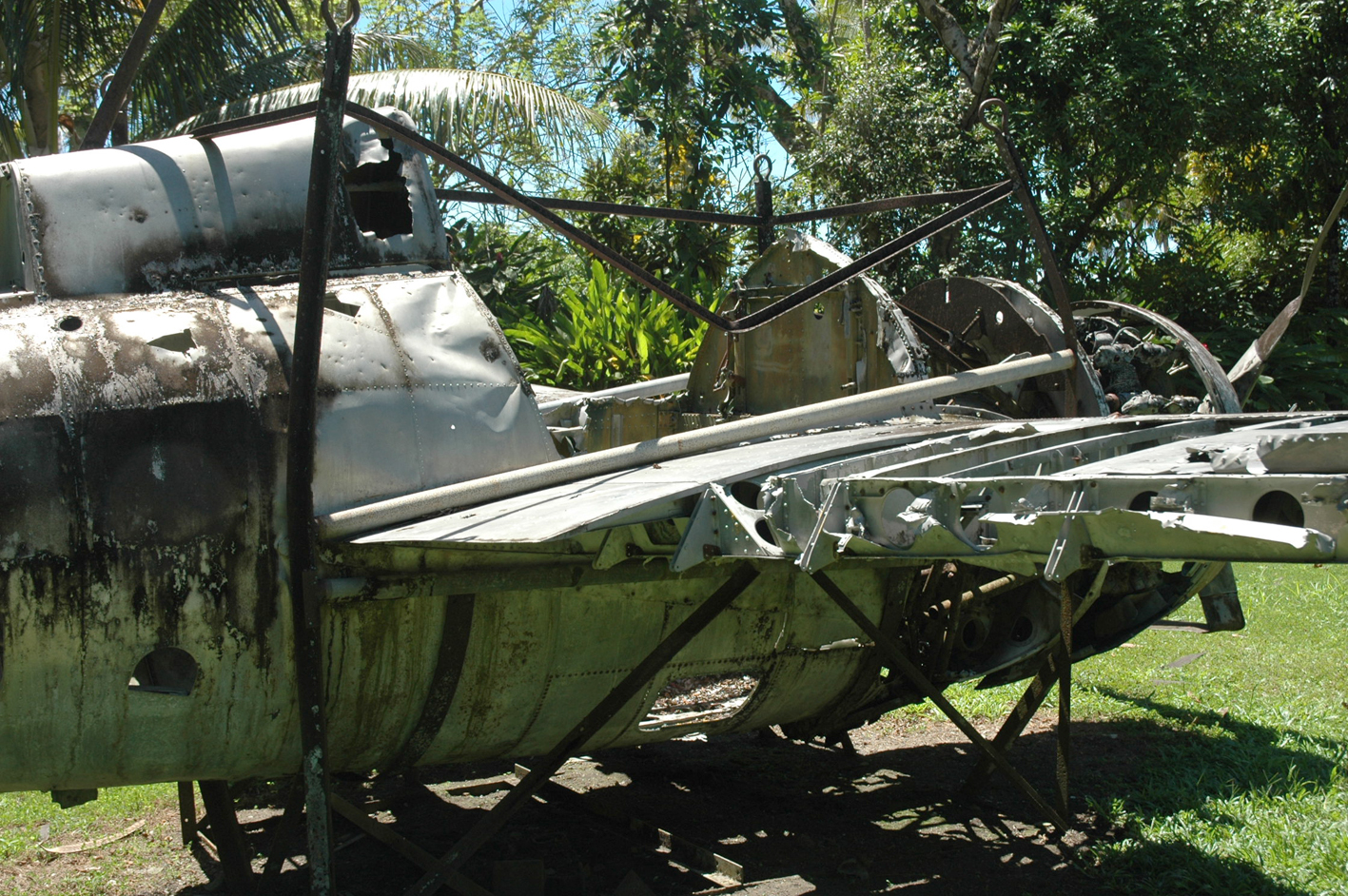
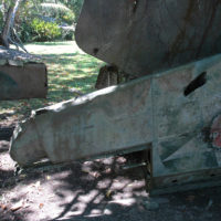
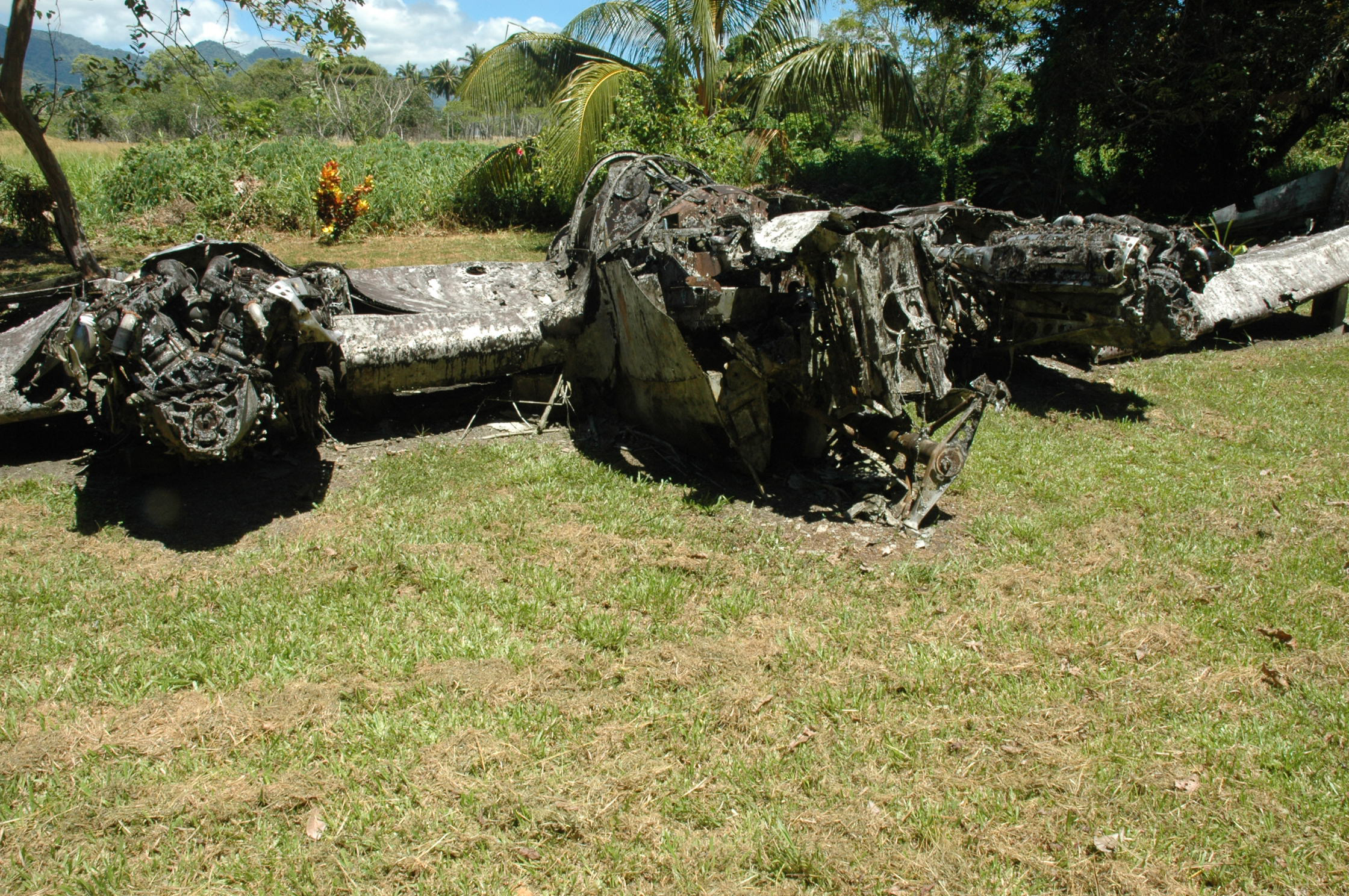
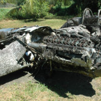
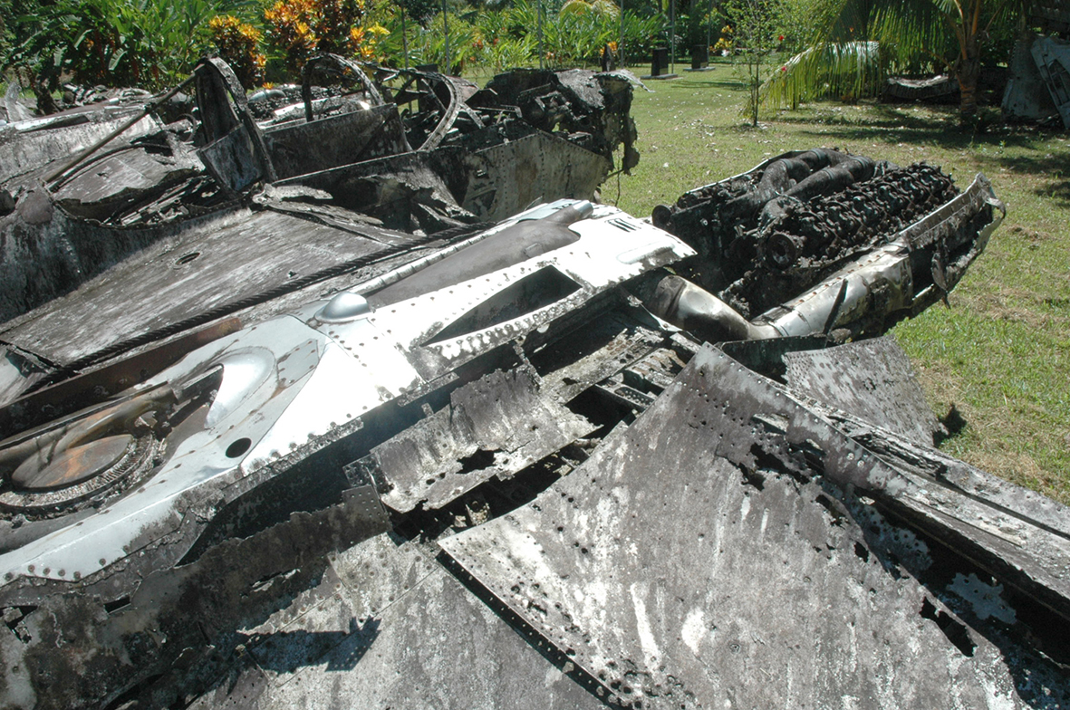
Many of the exhibits at the Vilu Museum have been recovered from the jungle or the seabed. It was here that I found the sad remains of an iconic P38 Lightning fighter, looking like a huge, dying albatross with its crumpled wings stretched out on the sun-baked lawn (Figures 9 – 11). It had reportedly crashed into the sea off Henderson Field. The circumstances of the crash, and whether the pilot survived, is not known.
-
- Figure 9
-
- Figure 10
-
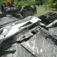
- Figure 11
Also displayed at Vilu, exposed to the elements except for a thin sheet of window glass, was a pathetically decomposing plaque with the insignia and initials of the Royal New Zealand Air Force (Figure 12). This was one of the very few pieces of physical evidence of the New Zealand presence that I saw during my time on Guadalcanal. There was no accompanying information about its origins.
How long these artifacts will survive exposed to the harsh tropical elements is debatable, yet with limited resources and no funding from the Solomon Islands government it seems there is little likelihood that they will ever be permanently covered.
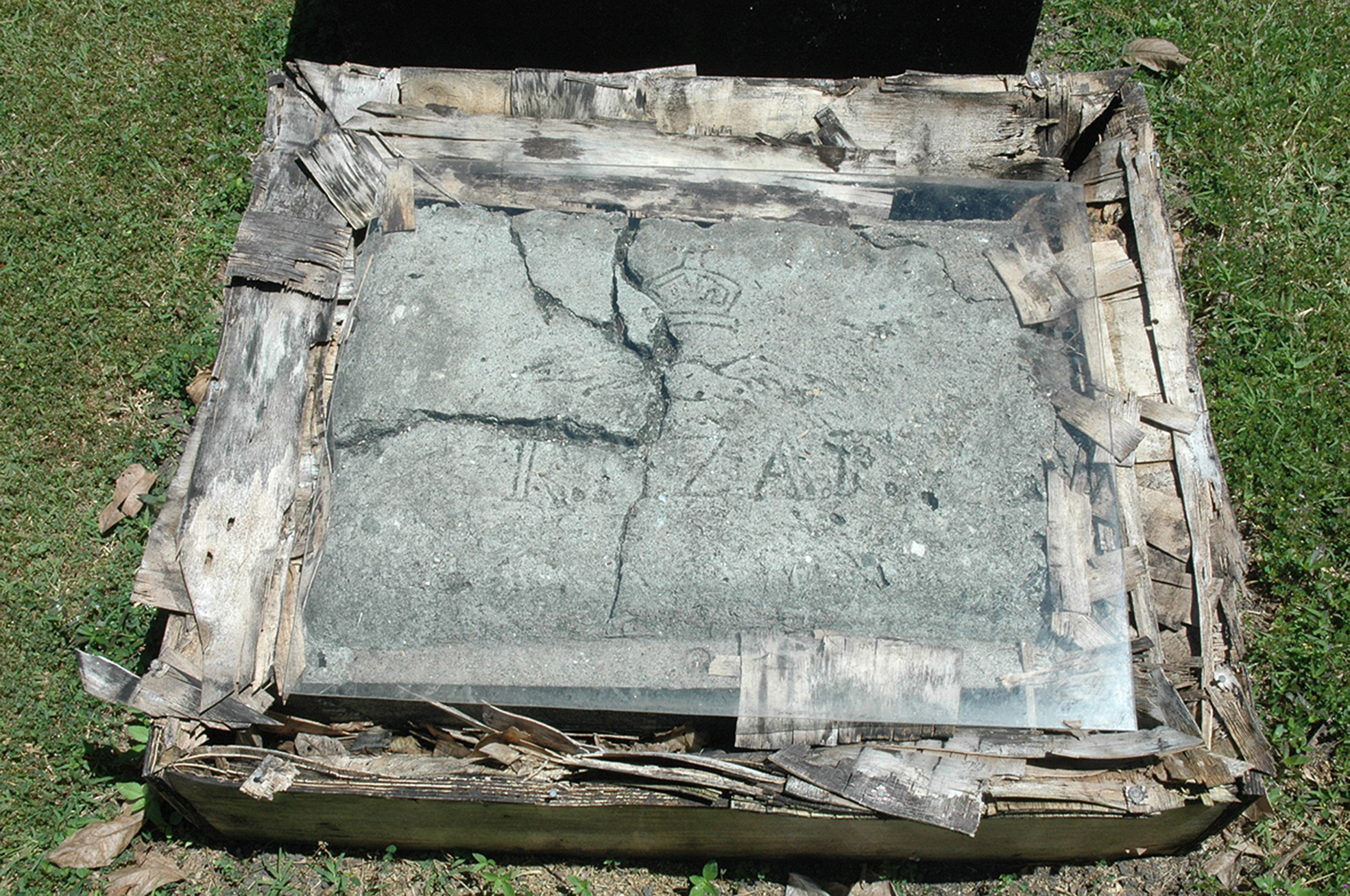
Figure 12
A couple of days later Stanley took me to the village of Barana on Mount Austen, south of Honiara. My father had taken part in a route march in full gear up the mountain, in heat which he described as being like an oven. The second I stepped out of Stanley’s battered but air-conditioned Toyota, I knew what he meant. The heat was debilitating.
The people in the village were very friendly and I was taken to a table laden with military bric-a-brac reclaimed from the jungle. I made it clear that I was not interested in buying anything, but would it be okay to take some pictures? “Of course”, I was told. The price was $SD20 (around $NZ5.00) per shot. I took a few pictures and handed over the money. Fair enough I thought, they are the people who go into the jungle to recover the relics, and you can’t blame them for wanting to make a living from it. (Figure 13: also see “World War 2 Souvenirs” Chapter).
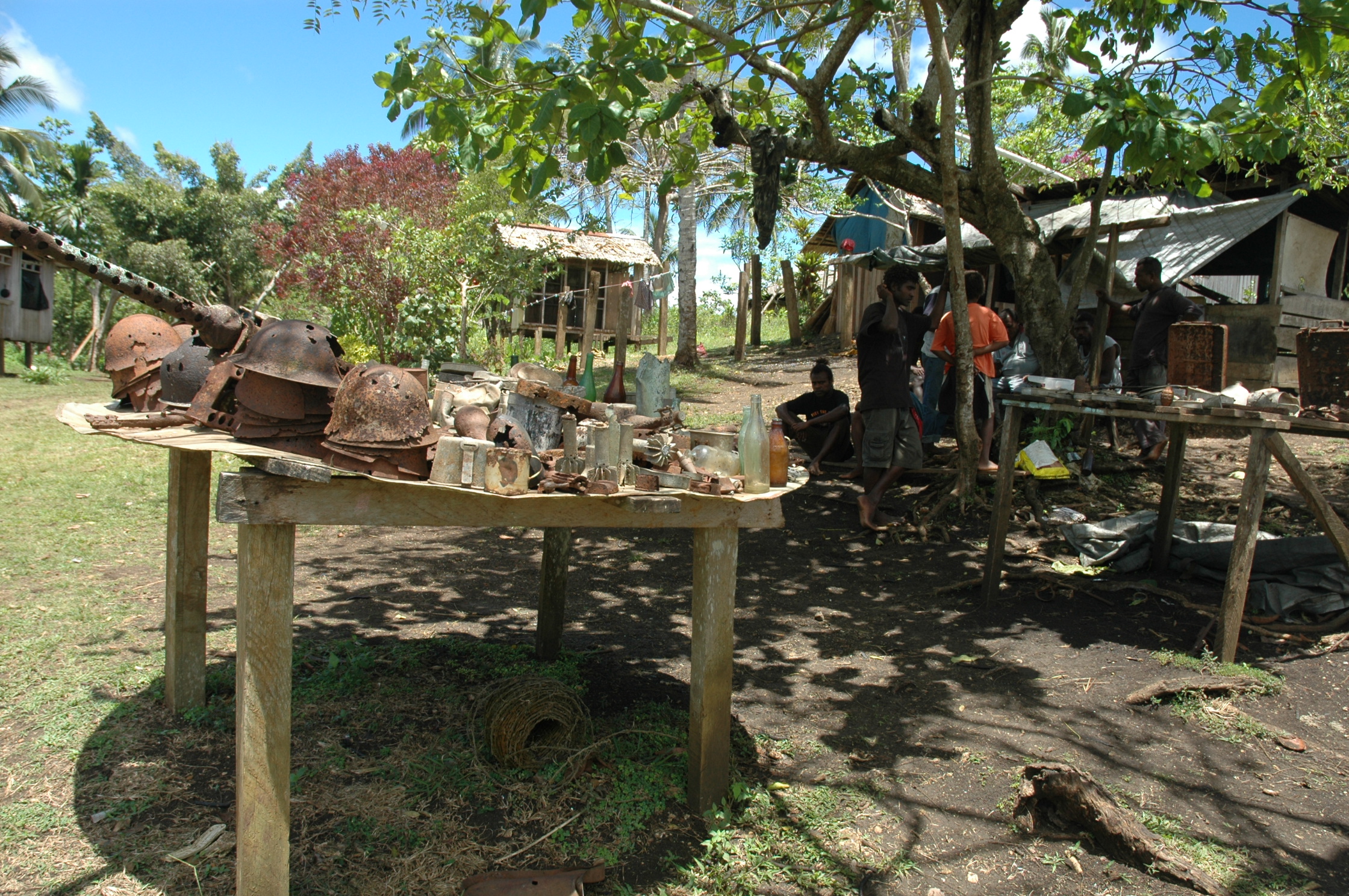
Figure 13
We drove down from Mount Austen and skirted the south end of the airfield to take a pot-holed dirt road to the site of the main New Zealand Army camp on Guadalcanal, right next to historic Edson’s Ridge. The year before the Kiwis arrived, the ridge, also called Bloody Ridge and sometimes Raiders Ridge after the American 1st. Raider Marine Battalion who defended it under the command of Lieutenant Colonel Merritt A. Edson, was the scene of one of the fiercest battles in the Pacific War.
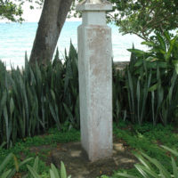
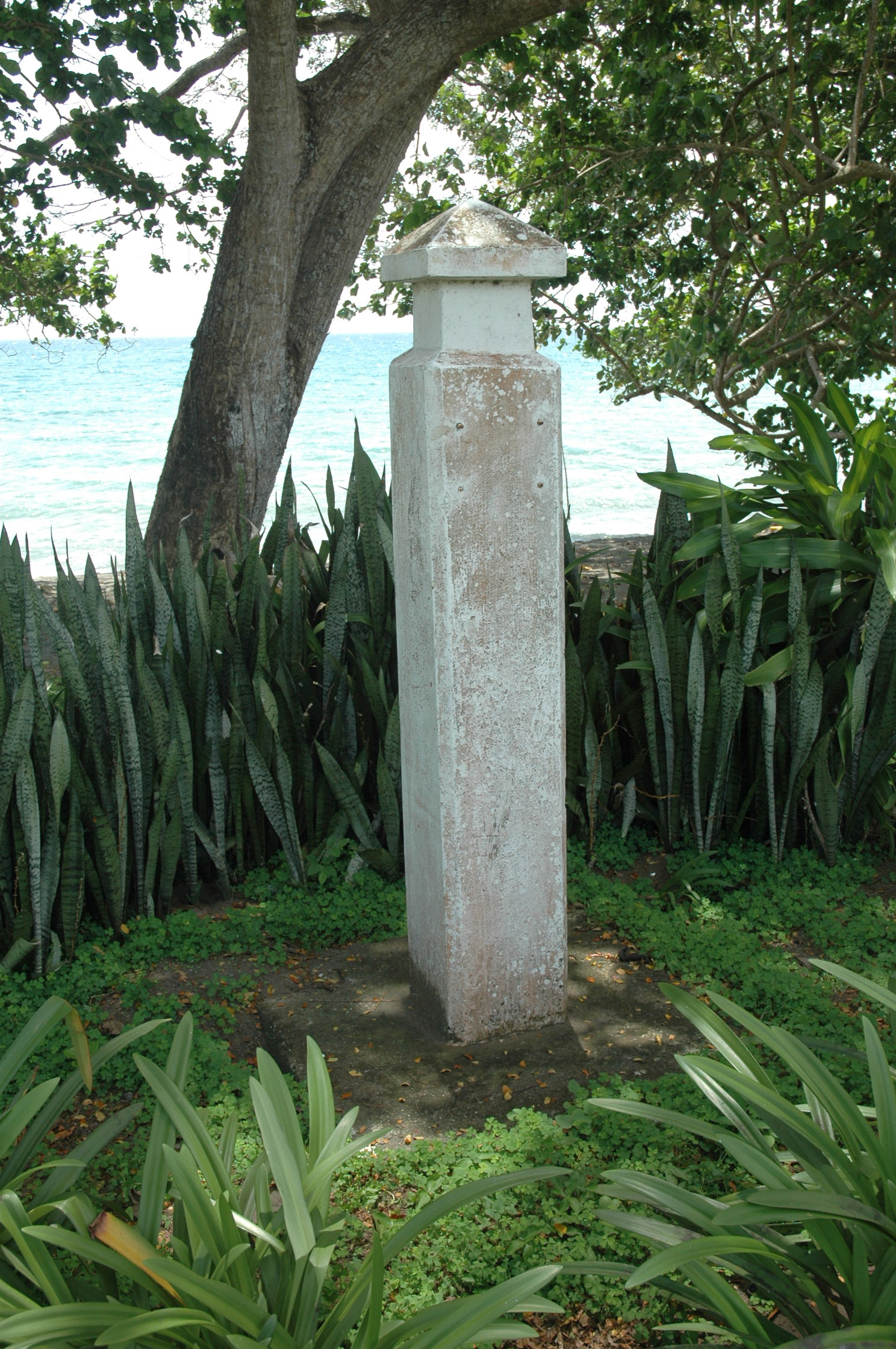
The Japanese attempted to retake the airfield, which they had almost finished making when the US Marines occupied it in August 1942, by attacking along the ridge overlooking the airfield on two nights from 12 – 14 September. This vicious battle was arguably the turning point of the War in the Pacific. Whoever possessed the Japanese made airfield controlled the vital shipping lanes between America and Australia and New Zealand. The coral ridge formed a natural pathway to the airfield and the Americans had anticipated that an attack would take place along it. Almost seven hundred Japanese were killed in repeated suicidal banzai attacks from the jungle to the south of the ridge over three nights. The Marines came close to being over-run: the flat area on the last hill at the north end of the ridge, where they turned the fight around, and Colonel Edson’s command centre during the fight, is marked by a crumbling white monument (Slide 14).

Slide 14
Stanley walked down the steep slope at the south end of the ridge that the Japanese had charged up in 1942 and snipped me a small souvenir piece of “bumble-wire”: barbed wire strung along the ridge with tin cans suspended from it that had warned the Americans of the approaching enemy at night (Figure 15: See also “World War 2 Souvenirs” chapter).
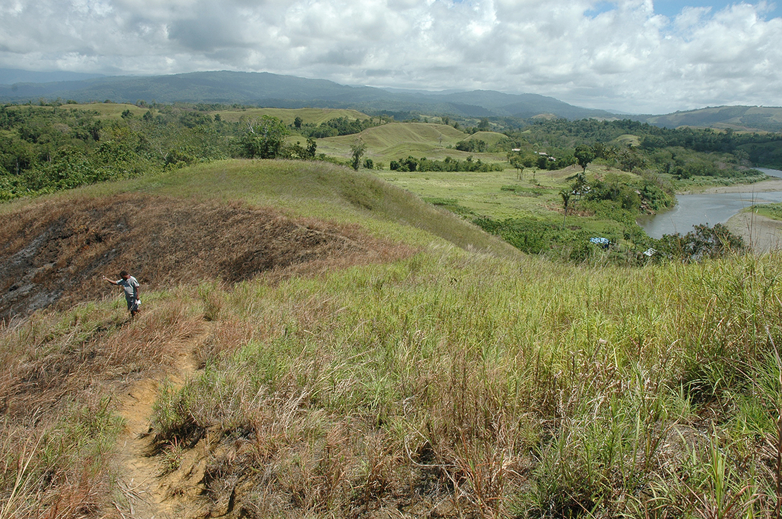
Figure 15
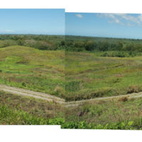
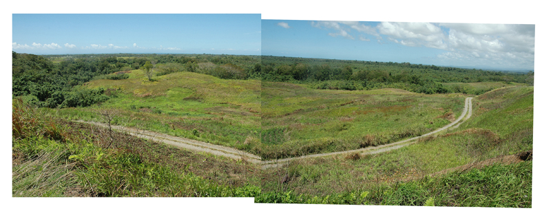
Twelve months after the battle, the New Zealand 8th Brigade made camp in a flat area surrounded by thick jungle next to Edson’s Ridge:
“Tuesday 14th September 1943: Our camp is in a tiny valley, under the heavy trees, shady but no water handy…
“Wednesday September 15 1943: All around our camp are evidences of a tough battle, several bayonets (Jap) some ammo’, hand grenades, even rifles have been found…There are hand grenades (American) all around our camp that haven’t exploded (duds). It is not safe to touch them and best to keep to the beaten paths. There are no Jap ones. I guess they worked as they should.”
It was an emotional experience to stand on the hill overlooking the New Zealand campsite. In Diary No. 2 on 11 October 1943, my father described standing on this very hill and watching a torpedoed American Liberty ship burning out in the Sounds.
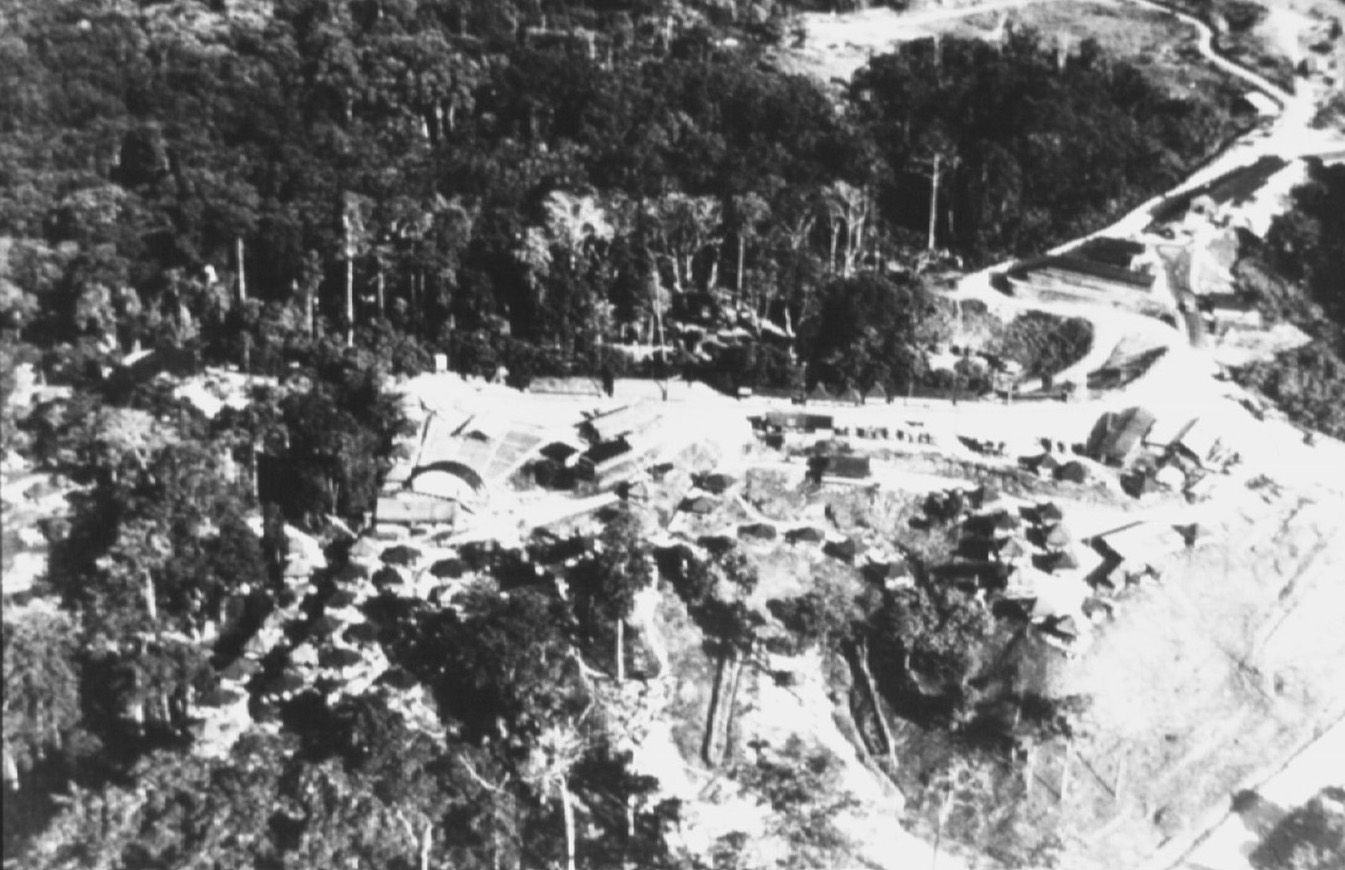
I have not been able to source any photographs of the campsite, other than a very blurry arial shot taken in 1943 (Figure 16), about the time Harry Stone was there. But as I stood on the hillside it was not difficult to imagine what it must have looked like 70 years before. Rows of khaki army tents, army trucks and artillery pieces lined up, young suntanned soldiers in lemon squeezer hats cleaning rifles, chatting over a cigarette, a mug of tea or a warm beer. I could almost hear the sounds of the camp as I stood gazing across the deserted, overgrown field (Figure 17).
-
- Figure 16
-
- Figure 17
At the north end of the ridge, over-looking the camp, we stopped to look at crumbling concrete paths and steps, the remains of the American Head Quarters (Figure 18). General Vandegrift, Commander of the 1st. Marine Division on Guadalcanal, and Colonel Edson must have trod these concrete paths.
A concrete monument placed by the American government sat amidst the ruins of the Head Quarters site, its bronze plaque likely stolen for scrap metal, it’s message long lost. I thought of Shelley’s Ozymandias: “Look on my works, ye mighty, and despair!”
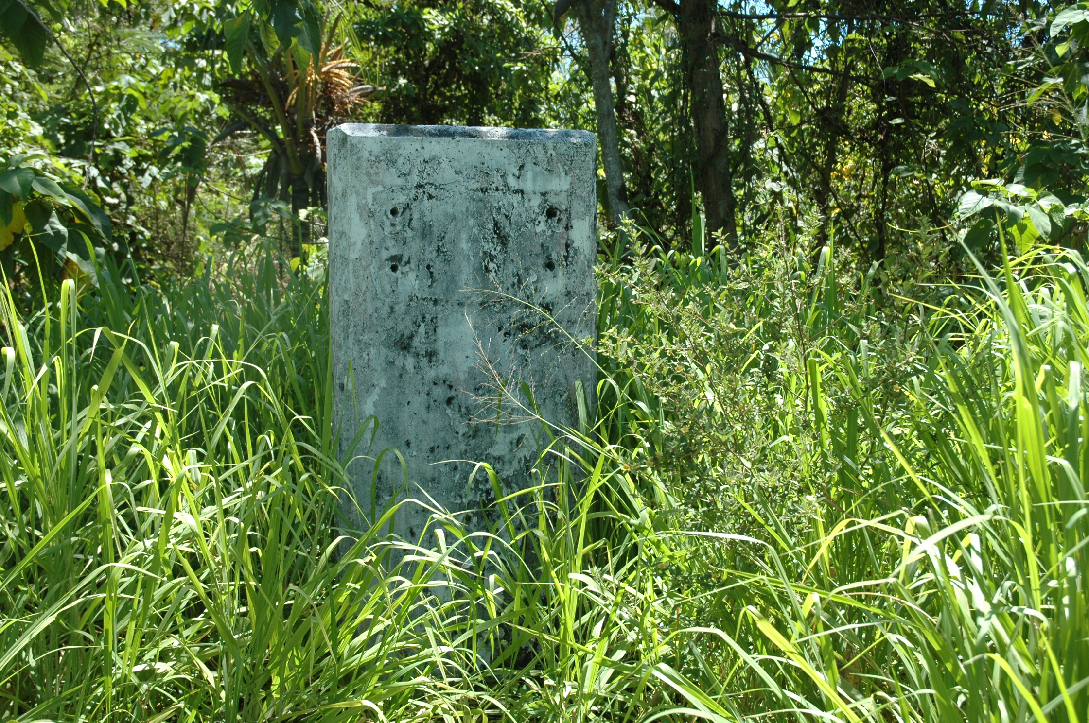
Figure 18
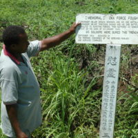
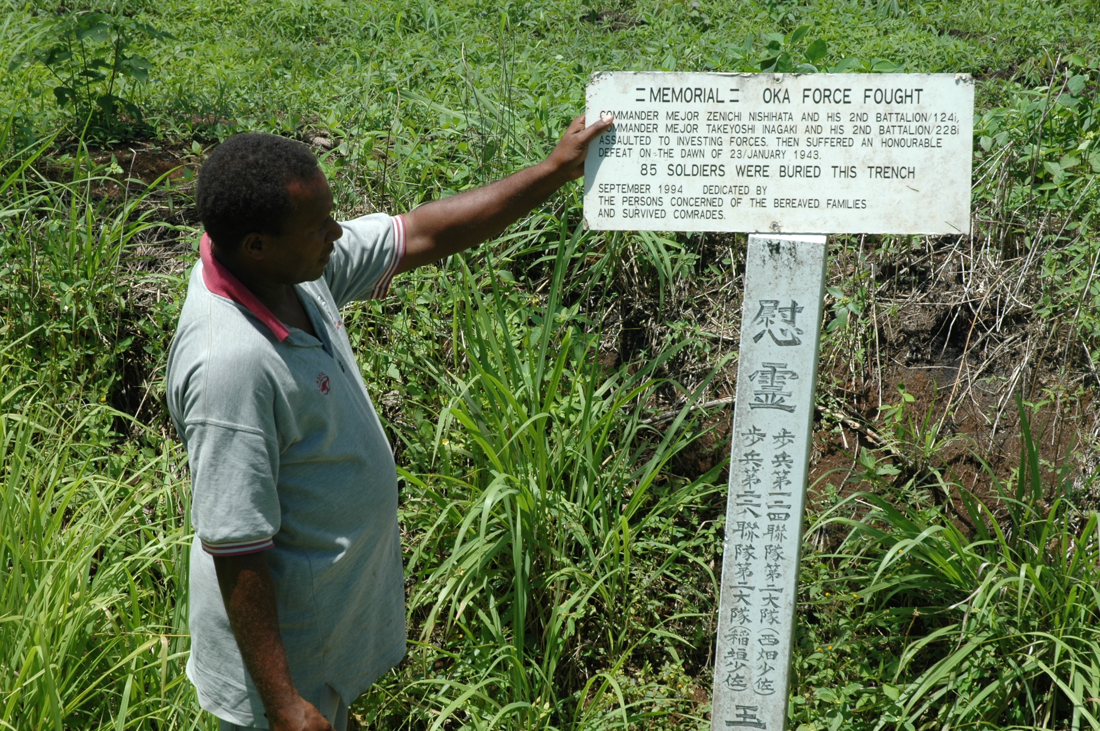
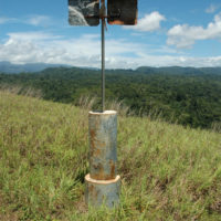
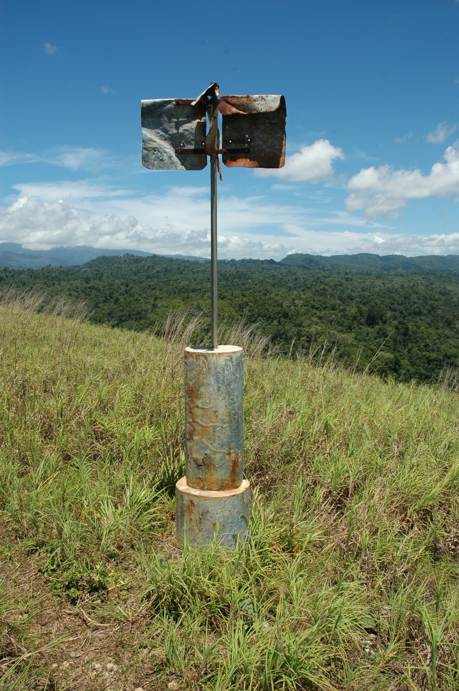
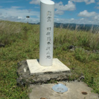
There are many memorial monuments in the landscape of Guadalcanal, erected by the Japanese and Allied governments to honour their dead soldiers and to mark historically important sites. More often than not the monuments are decaying and covered in graffiti, the bronze plaques that were once attached to them jimmied off, Stanley told me, by the locals. The Japanese memorials on the whole are simpler, and more vulnerable to the elements. Some mark important battle sites (Figures 19), some are so damaged their original purpose has lost all meaning (Figure 20), and others appear to have been erected by individual families or surviving comrades to honour a fallen relative or fellow soldier (Figures 21 and 22).
-
- Figure 19
-
- Figure 20
-
- Figure 21
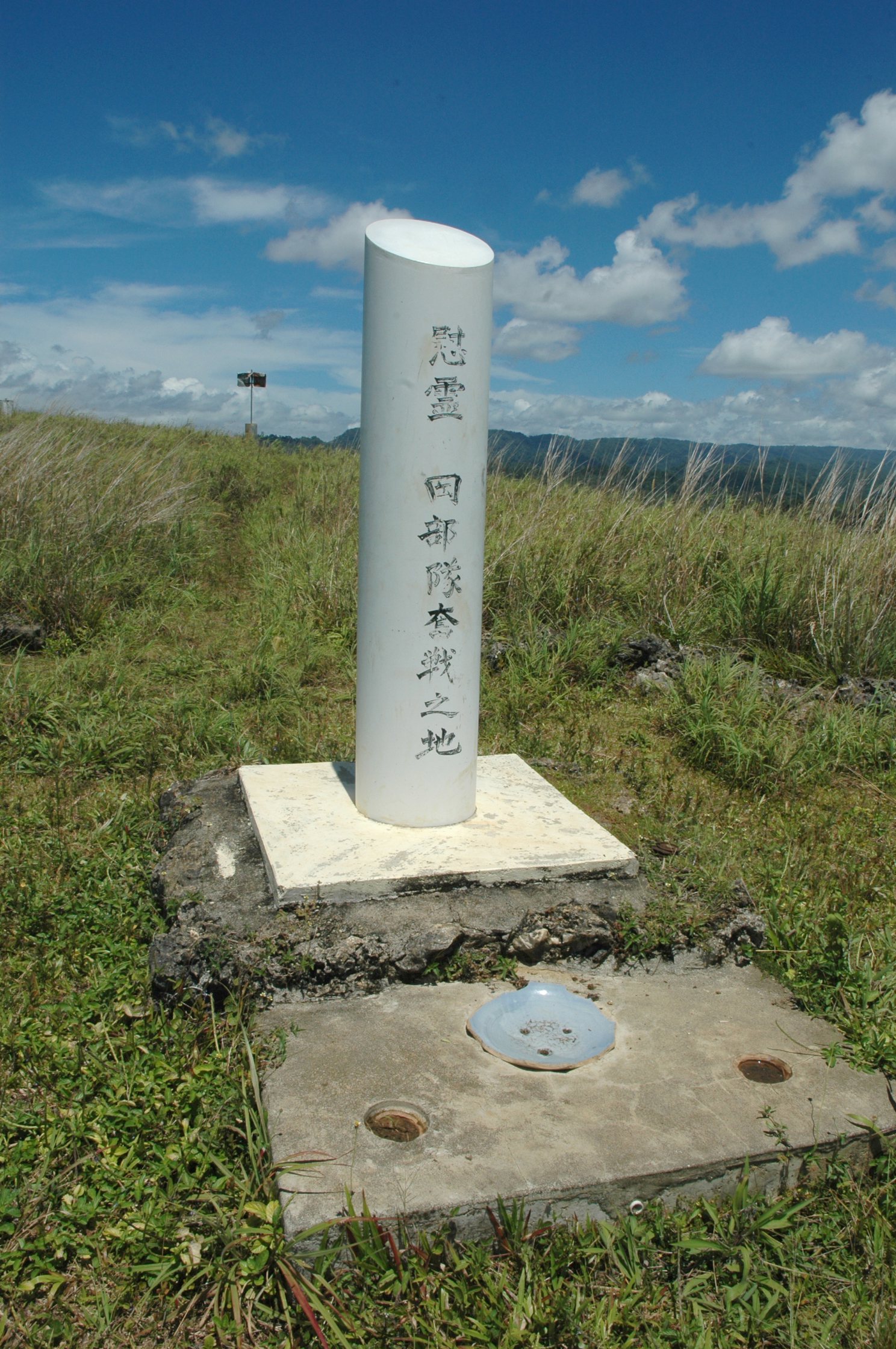
Figure 22
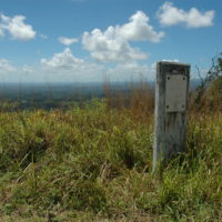
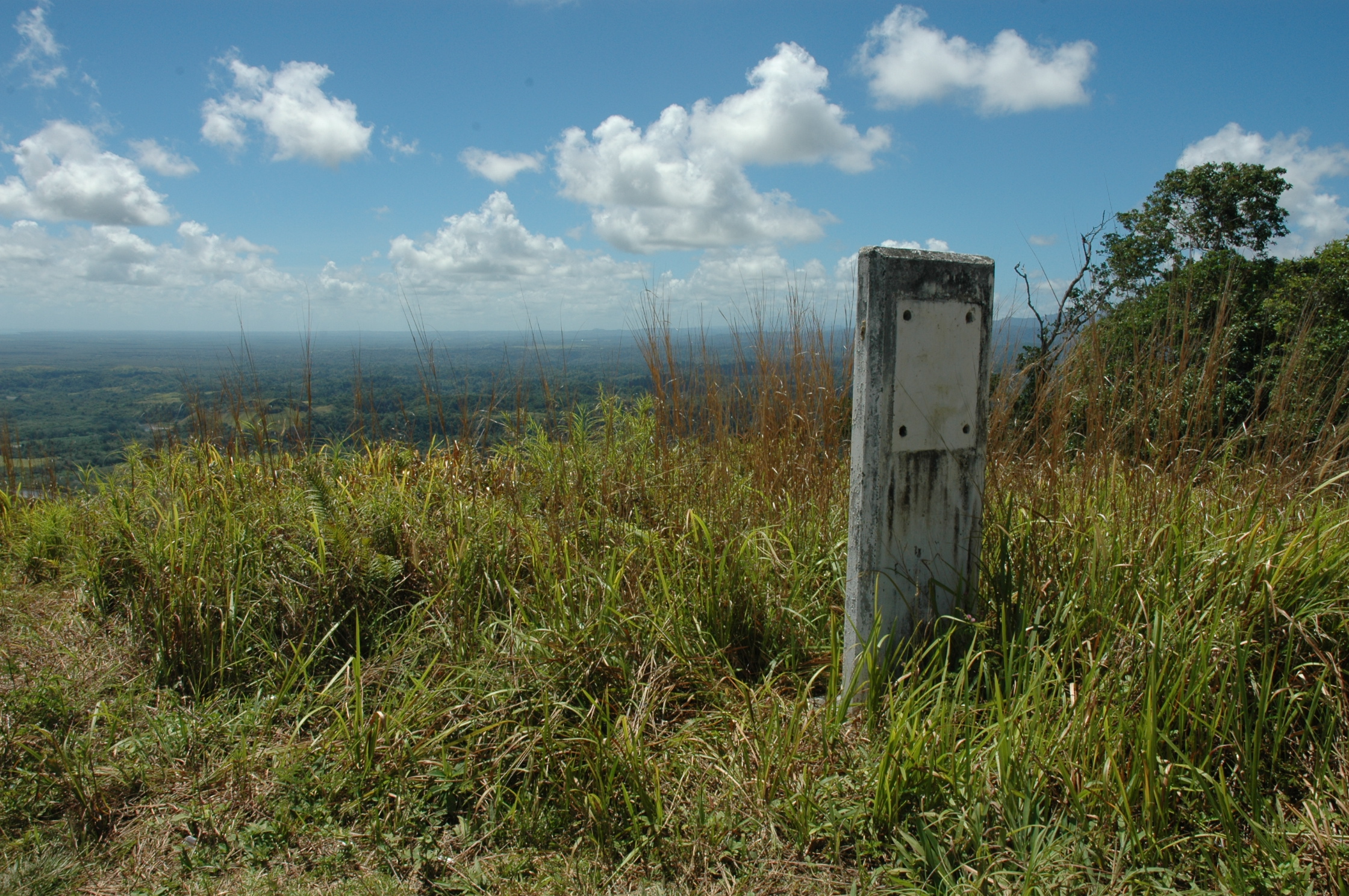
There are also simple American memorials, such as this one with the signage removed, on Mount Austen (Figure 23) and one, also with its bronze plaque removed, near Kukum Beach (Figure 24). It was frustrating to not be able to access the information that was once attached to the post.
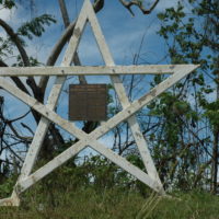
Most of the American memorials are more substantial, such as the grand design on Mount Austen commemorating “The Final Destruction of Organised Japanese Forces” (Figure 25). The remnants of the units that were defeated on Edson’s Ridge were cornered and obliterated here by the Americans, using tanks and other weaponry.
-
- Figure 23
-
- Figure 24
-
- Figure 25
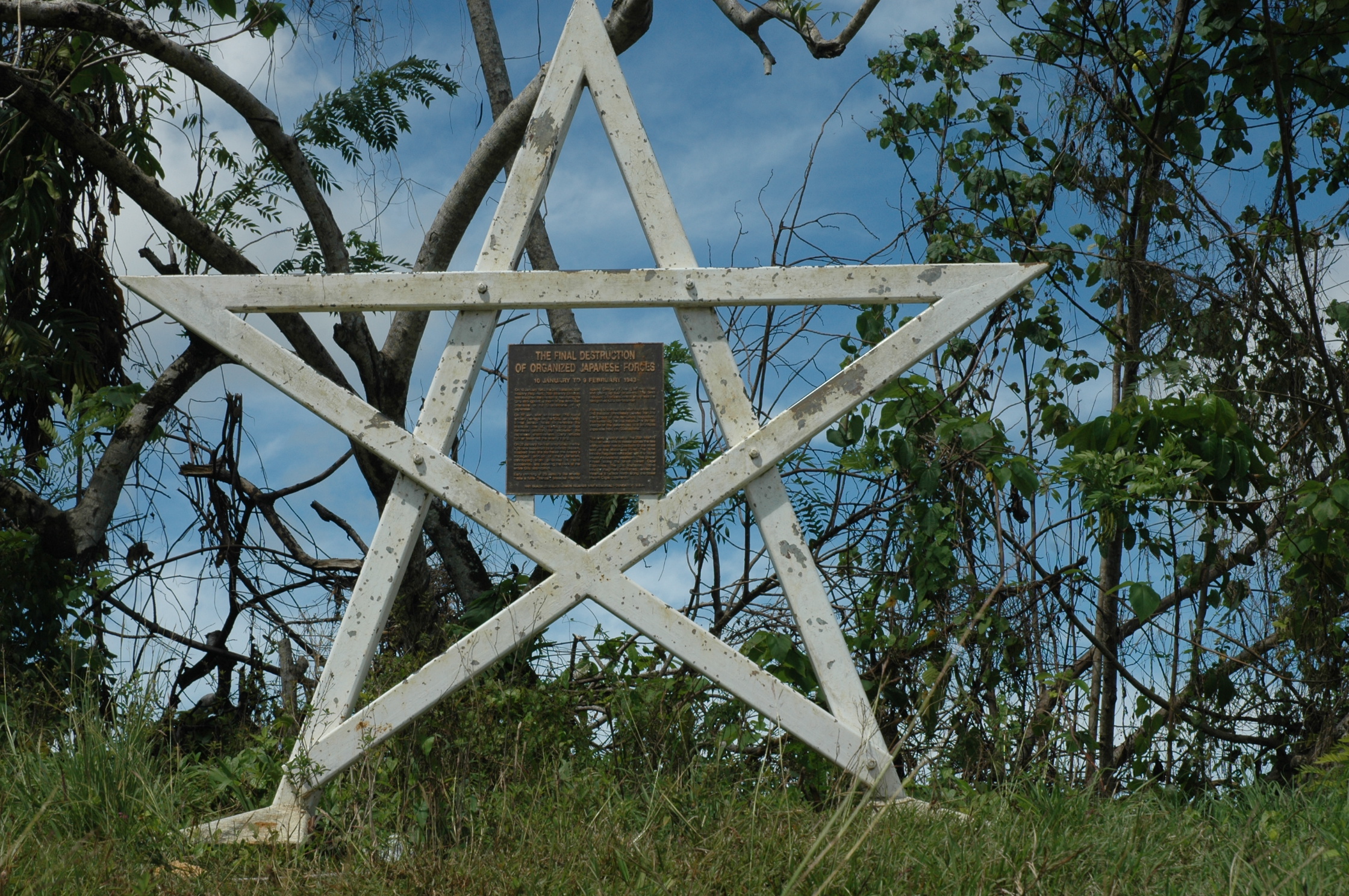
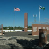
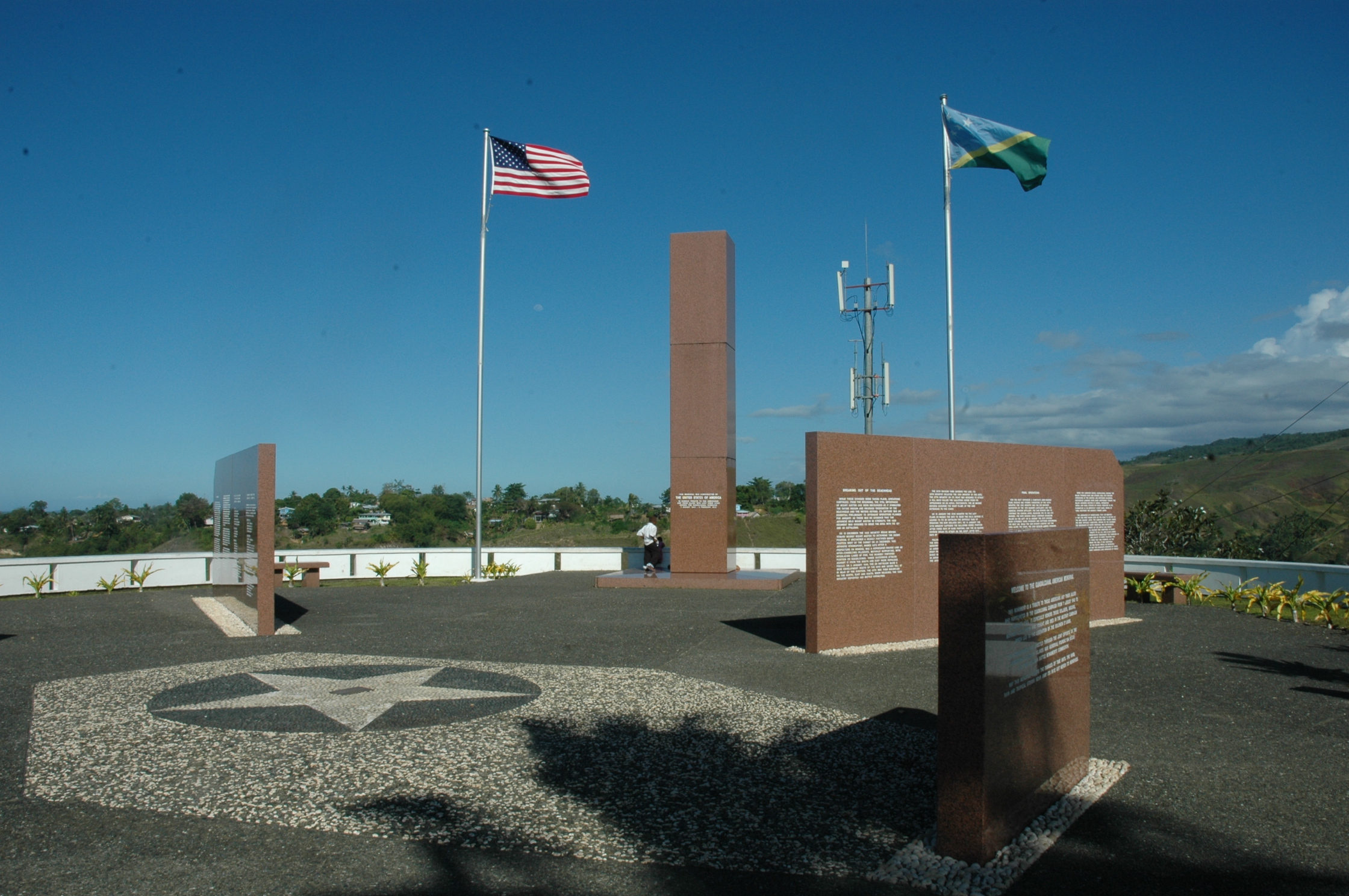
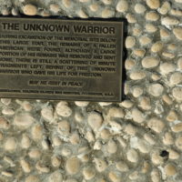
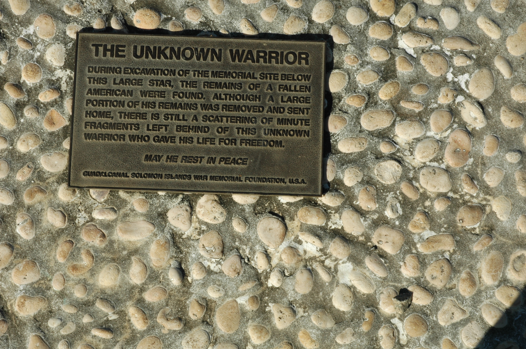
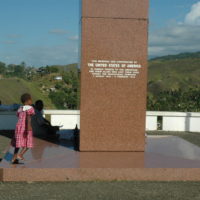
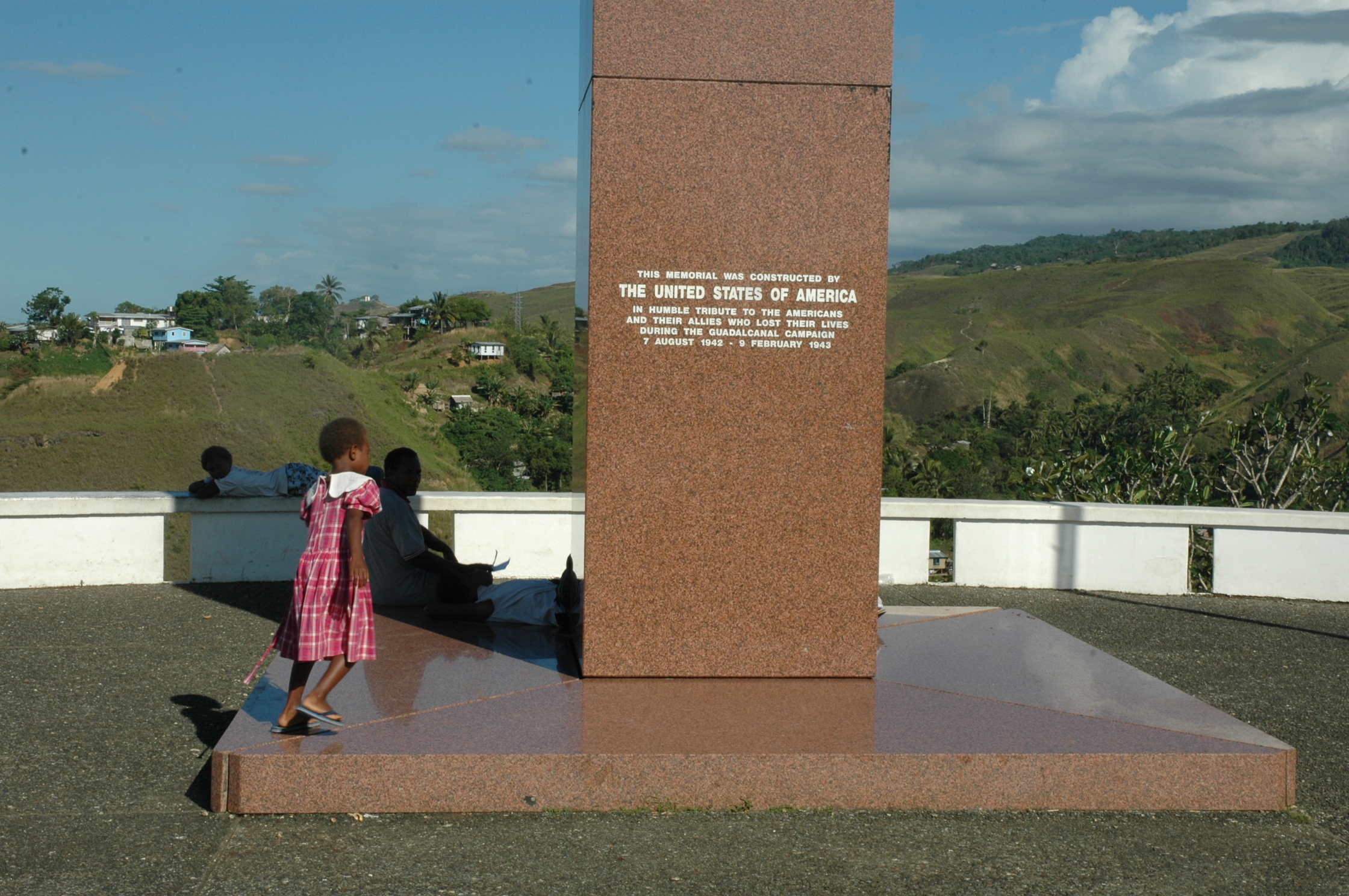
The most substantial, and certainly the most well maintained, memorial is the one the American Guadalcanal-Solomon Islands War Memorial Foundation and The American Battle monuments Commission erected on top of a hill behind Honiara, “In humble tribute to the Americans and their Allies who lost their lives during the Guadalcanal Campaign 7 August 1942 – 9 February 1943” (Figure 26). The star on the ground on the left in the photograph in Figure 26 covers some of the remains of an unknown American soldier which were discovered during preparations for the site. A small bronze plaque records this (Figure 27).
-
- Figure 26
-
- Figure 27
-
- Figure 28
While the American Memorial is kept clean and tidy, and is apparently respected by the locals (Figure 28), possibly in response to the stainless steel plaque erected at the entrance (Figure 29), tagging and graffiti have desecrated many of the memorials further away from the main centre.

Figure 29
The large Japanese memorial on Mount Austen has been badly graffitied (Figure 30). Stanley explained that the dilapidated condition of most of the memorials on Guadalcanal is a testament to the fact that for many, if not most local people the war is forgotten history. To most locals today the war is irrelevant to the daily grind of survival in Guadalcanal. While most of the islanders supported the Allies and some worked with them to defeat the Japanese, especially as Coast Watchers, the war was regarded as something that was thrust on the Solomons by warring super-powers. Much of the local population headed into the interior during the Japanese occupation.
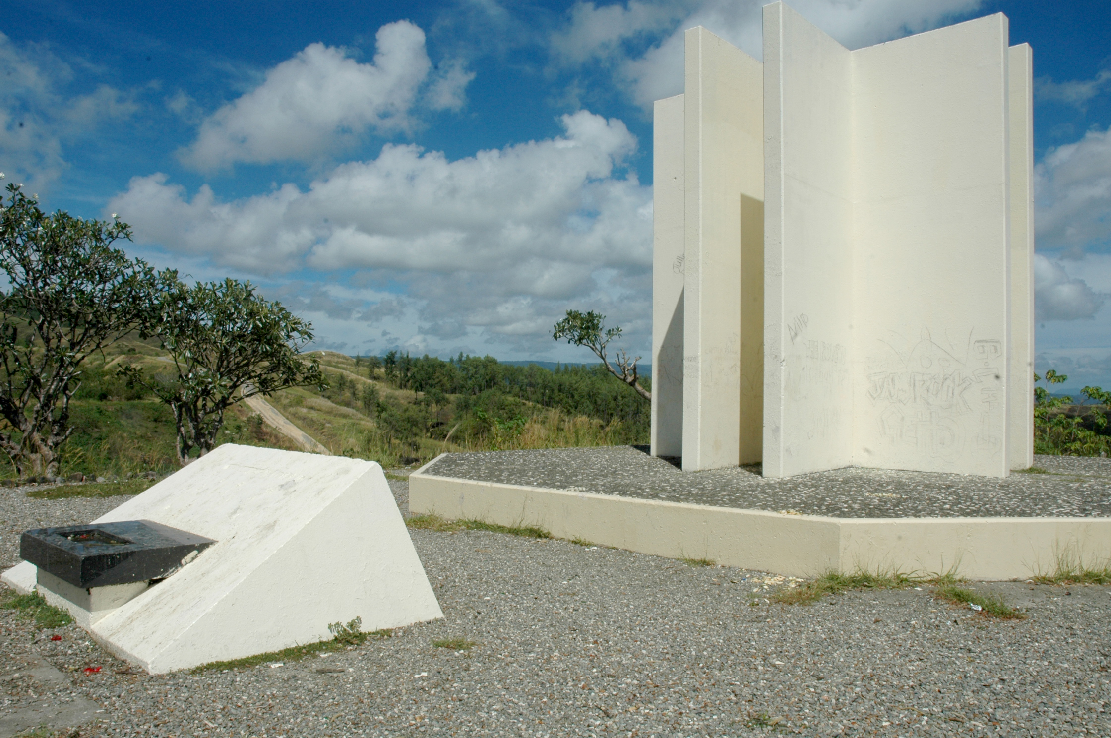
Figure 30
In addition to the vandalism perpetrated upon them, many monuments and memorials that were erected with the best of intentions by governments and organisations after the war have inevitably deteriorated in the harsh climate and tropical conditions. The resources and motivation to maintain them are practically nonexistent: the jungle is gradually reclaiming many of them.
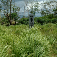
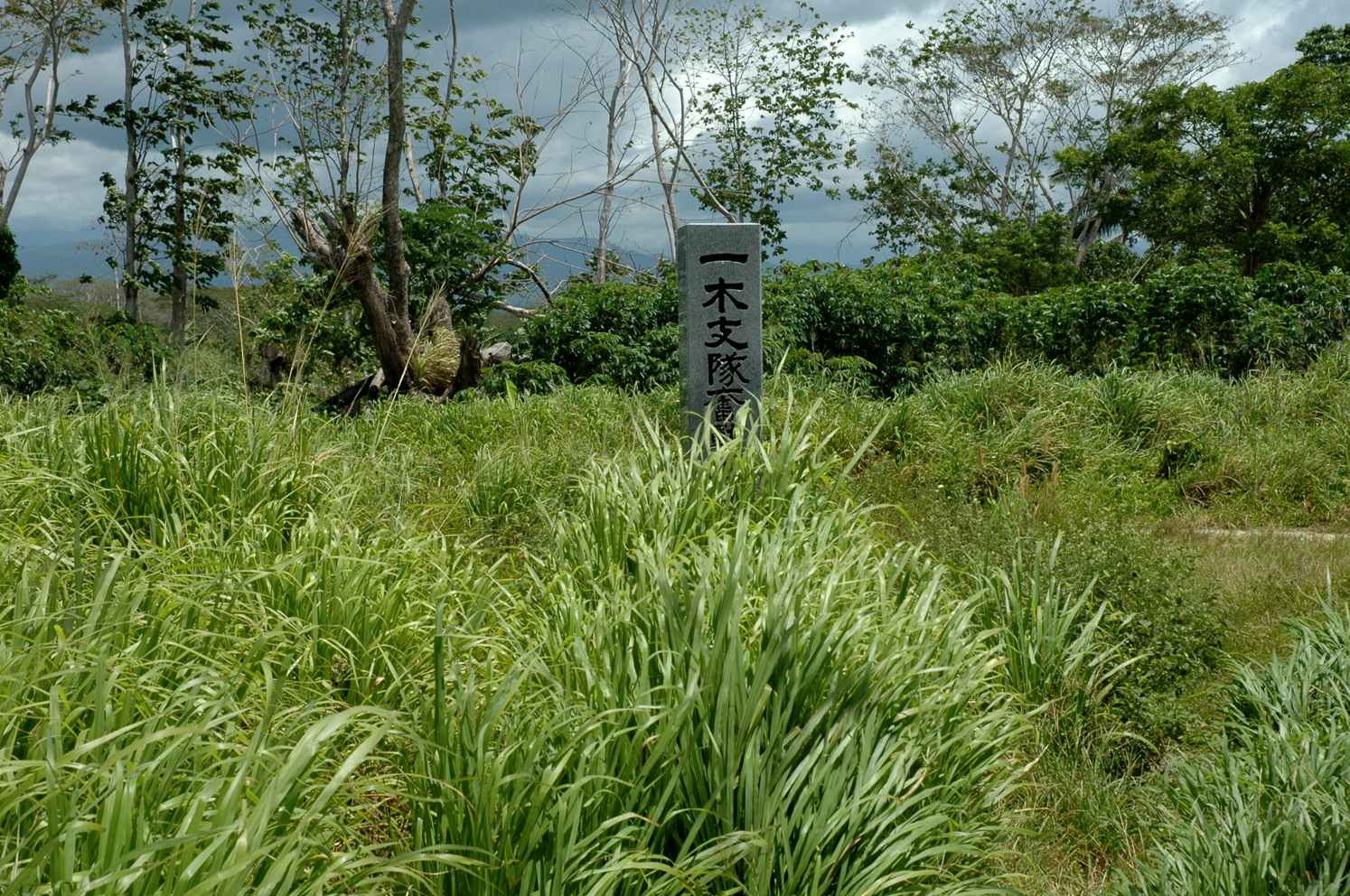
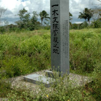
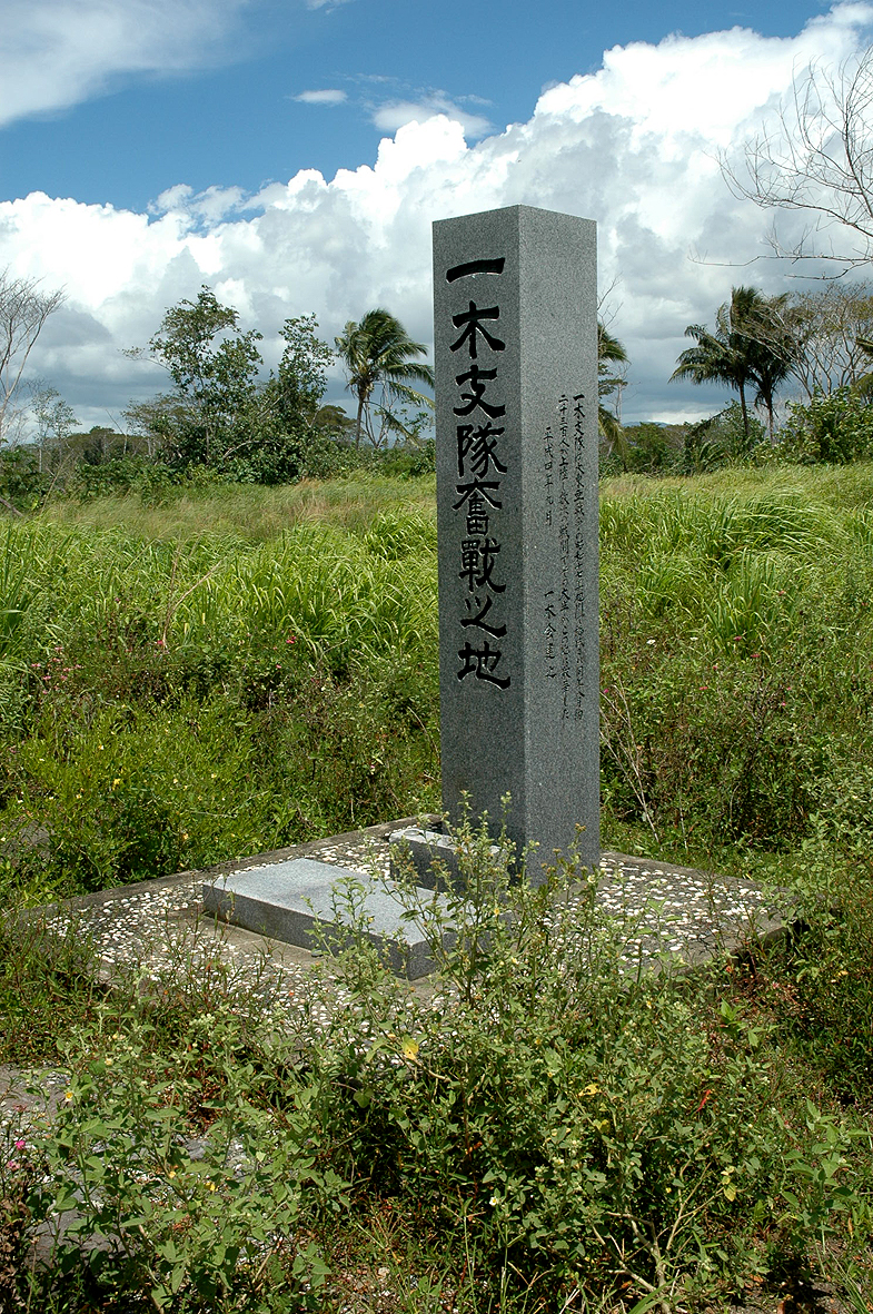
After some difficulty finding a side road, which led through tall grass to the beach from the Kukum Highway, Stanley took me to the site of the Battle of the Ilu River, also known as the Battle of Tenaru (Slides 31 – 33). At this site 800 soldiers of the Ichiki Regiment were massacred by machine guns as they attempted to break through the American perimeter line at night and take the airfield from the east. The men were commanded to rush at the American defenders in a “banzai charge”: the belief that shear numbers and determination, coupled with Japanese righteousness, would defeat the enemy. This belief was no match for the firmly entrenched American machine guns.
Maps made at the time created some confusion about the name of this small river. The area to the east of the river is called Tenaru, while the river’s name is the Ilu. The name Alligator Creek was also used by the Marines who saw alligators devouring the Japanese corpses in the water on the day after the firefight.
-
- Figure 31
-
- Figure 32
-
- Figure 33
A granite monument erected by the Japanese, in better condition than most on Guadalcanal, stands in a field of long grass to the east of the river. The wind rustling softly through the grass produced an eerie evocation of the fighting and death that the place had witnessed (Figures 34 and 35).
-
- Figure 34
-
- Figure 35
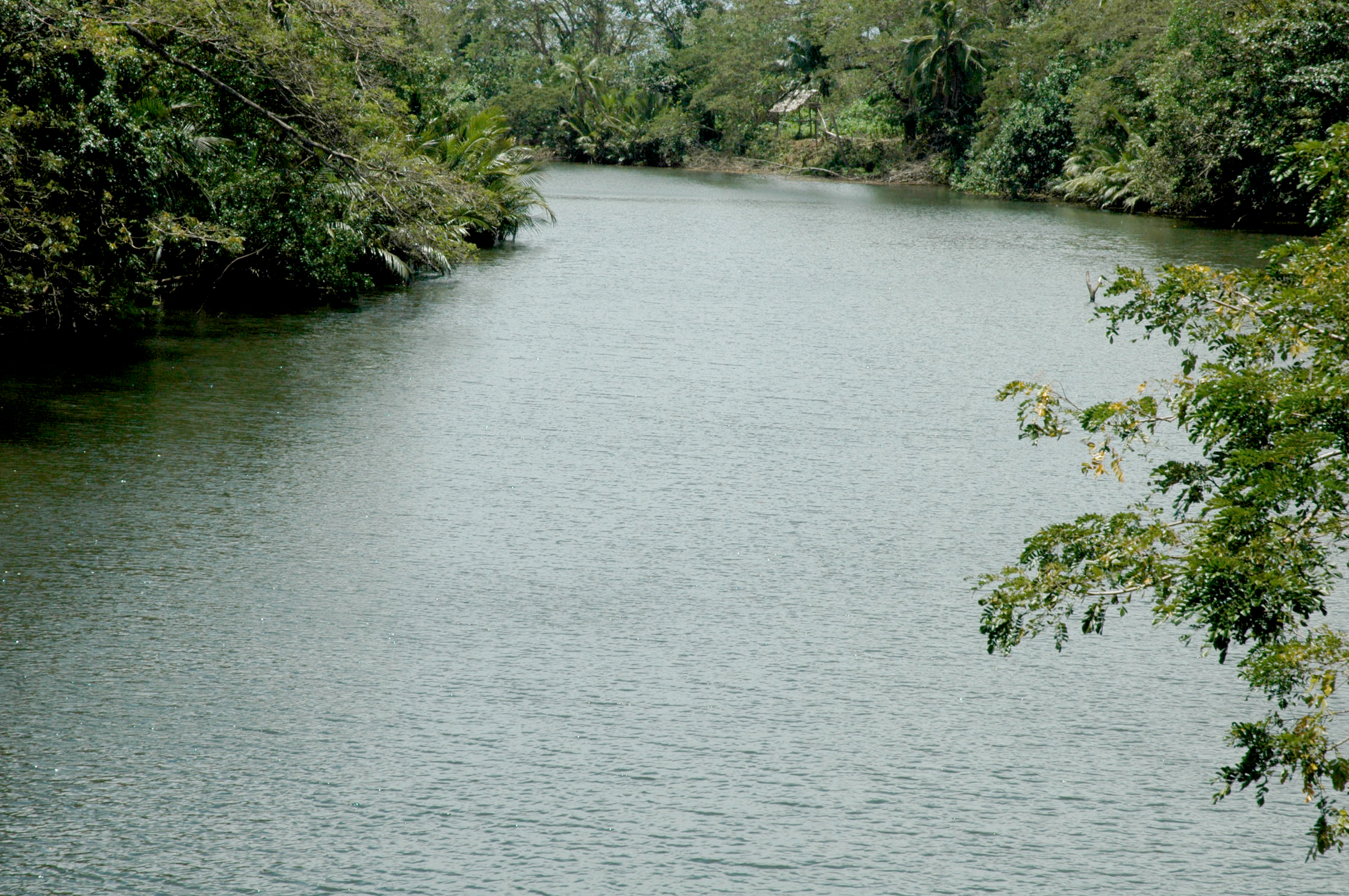
Further to the east of Ilu River is Red Beach, where the Marines first came ashore and where facilities were later built for landing materials and personnel. The remains of the wharves are still visible along the foreshore. The New Zealand troops landed between here and Lunga Point, which is further to the west (Slide 36). This is where Harry Stone landed on 15 September 1943.
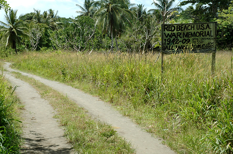
Figure 36